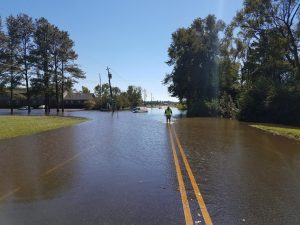
Flood Protection Information
The City of Goldsboro is a participant of the Community Rating System (CRS), which recognizes and encourages community floodplain management activities that exceed the minimum National Flood Insurance Program (NFIP) standards. Depending upon the level of participation, flood insurance premium rates for policyholders can be reduced up to 45%. City of Goldsboro policyholders currently receive a 10% reduction in their flood insurance premium rates. Besides the benefit of reduced insurance rates, CRS floodplain management activities enhance public safety, reduce damages to property and public infrastructure, avoid economic disruption and losses, reduce human suffering, and protect the environment. Participating in the CRS provides an incentive to maintaining and improving a community’s floodplain management program over the years. Implementing some CRS activities can help projects qualify for certain other Federal assistance programs.

Documents and Web Links
Neuse River Basin Regional Hazard Mitigation Plan
This link provides access to the Wayne County Neuse River Basin Regional Hazard Mitigation Plan (HMP). A regional hazard mitigation plan is classified by the Federal Emergency Management Agency (FEMA) as any mitigation planning effort involving two or more county jurisdictions. This Hazard Mitigation Plan involves a five-county region including Greene County, Jones County, Lenoir County, Pitt County, and Wayne County. All the municipalities within these five counties are also participants in this plan, including Hookerton, Snow Hill, Walstonburg, Maysville, Pollocksville, Trenton, Kinston, La Grange, Pink Hill, Ayden, Bethel, Falkland, Farmville, Fountain, Greenville, Grifton, Grimesland, Simpson, Winterville, Eureka, Fremont, Goldsboro, Mount Olive, Pikeville, Seven Springs, and Walnut Creek.
Hazard mitigation planning is intended to construct a framework for the prevention and reaction to disasters if and when they may occur. The framework created by this plan will help to instill an ongoing effort to lessen the impact that disasters have on citizens and property throughout the region. There are many aspects of mitigation planning that cannot be addressed at the regional level. In order to address this issue, this plan will outline strategies that will deal with both regional mitigation initiatives and strategies that serve the needs of each individual participating jurisdiction.


